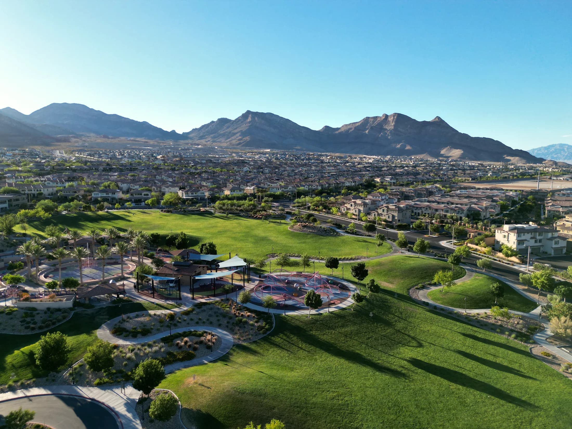
- What it is
- One master-planned community on the valley's western edge, 22,500 acres of it, built village by village since 1990.
- Known for
- Villages, parks and trails, Red Rock at the back door, Downtown Summerlin, and a western edge still under construction.
- Major corridors
- CC-215 · Summerlin Parkway · Charleston · Sahara · Far Hills · Town Center
- Names you'll hear
- Summerlin West · Summerlin SouthDowntown Summerlin · The RidgesThe Paseos · StonebridgeKestrel · Grand Park
Las Vegas Area Guide
Almost everyone moving to Las Vegas hears about Summerlin in the first week. It's the answer people give fastest, and it's usually a good answer. The trouble starts one question later, when you try to work out what you've actually been told.
Because Summerlin isn’t a neighborhood. It’s 22,500 acres (about 35 square miles) of master-planned community that has been built village by village since 1990 and still isn’t finished. Inside it you’ll find streets with thirty-year-old trees and streets with staked saplings, guard-gated custom homes and lock-and-leave townhomes, a village where you can walk to a ballgame and villages where the nearest coffee is a drive. All the same address. All genuinely Summerlin.
So this guide does the thing the brochures skip. Where the community actually is, what its parts are called, why “Summerlin West” doesn’t mean what most people think, what’s being built right now, and what changes about your day depending on which village you land in.
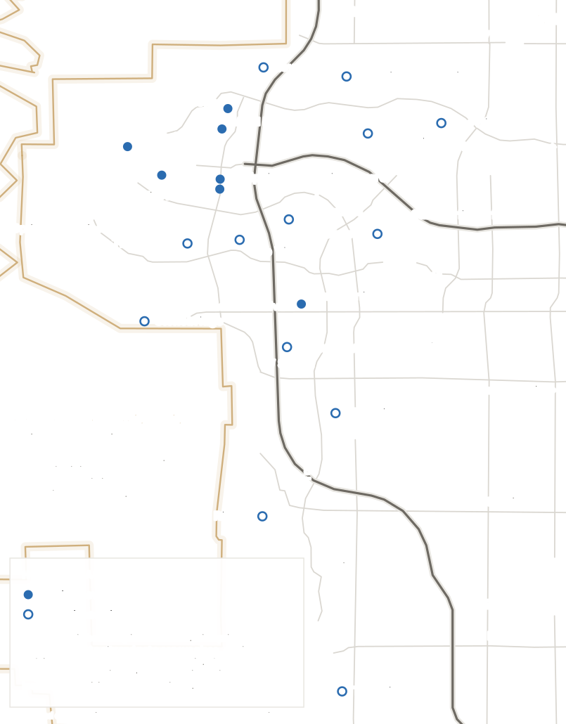
Summerlin Las Vegas Map
Where exactly is Summerlin?
Summerlin runs north–south down the western edge of the valley, which is why this map is a tall strip rather than a tidy square. That shape is the first useful thing to know about it: the community is roughly twice as long as it is wide, and the drive from one end to the other is a real drive.
The CC-215 runs straight through the middle. Villages west of it are what people mean by Summerlin West. The gold line on the left is the Red Rock Canyon conservation-area boundary: federal land, and the reason the western villages stop where they do.
What's on this map
- The CC-215 Beltway
- Runs north–south straight through the community. It's the line locals actually divide Summerlin by: west of it is Summerlin West, east of it is older Summerlin.
- Summerlin Parkway
- The east–west connector out to US-95 and downtown. It's a parkway, not a beltway, and it's how most of Summerlin gets to the rest of the city.
- Red Rock Canyon National Conservation Area
- The gold line is the real BLM boundary. It's why the western villages stop where they do. Summerlin can't grow past it.
- Downtown Summerlin
- The commercial core, off Sahara at the 215. Not downtown Las Vegas, which is nine miles east.
- Summerlin Centre
- The village wrapped around Downtown Summerlin, off Charleston just west of the 215. Still selling new homes.
- Kestrel, Kestrel Commons, Redpoint and Redpoint Square
- Two pairs of newer Summerlin West districts. Each pair shares one label on the map because they sit within a few hundred meters of each other.
- Grand Park and La Madre Peaks
- The current western frontier of the master plan, north of Far Hills and up against the mountains.
- The Vistas, The Paseos and Stonebridge
- Also west of the 215, and also Summerlin West, but built years earlier. Worth seeing on the map, because it's the thing people most often get wrong.
- Sun City Summerlin, The Trails, The Hills, The Arbors and The Canyons
- The established villages east of the beltway, in the part of the community that went up first. The Crossing and The Pueblo sit among them and are left off the drawing for room.
- The Ridges, The Willows and The Cliffs
- The southern end, with The Gardens, Siena and The Mesa filling the gaps between them. The Cliffs is Summerlin's southernmost village and sits below Russell Road, further south than most people picture Summerlin reaching.
There is no Summerlin boundary drawn on this map, on purpose. Summerlin is a private master-planned community, so its extent is defined by the developer’s plan rather than by any government map, and Summerlin publishes that line itself as the official Summerlin Border Map. That artwork is theirs; we’re not going to copy it, trace it or redraw it. Nor is there a government boundary that stands in. Summerlin is not a city, not a Clark County town, and not a census place. Drawing a line and labeling it “Summerlin” would have made a cleaner picture and taught you something false. For the official border, go to Summerlin’s own maps and guides. A few smaller villages (The Crossing, The Pueblo, The Gardens, Siena, The Mesa) are named in the key below and covered in the villages section rather than lettered onto the drawing, because a map you can read beats one that lists everything. Roads and the conservation-area boundary come from OpenStreetMap.
Where Summerlin actually is
Summerlin occupies the western edge of the Las Vegas Valley, from roughly the Lone Mountain area in the north down past Russell Road in the south, with Red Rock Canyon behind it and the rest of the city in front. Howard Hughes describes it as sitting about nine miles west of the Strip. It is one property development, not a district of the city, which is the source of most of the confusion that follows.
It is not a city, and it never has been
There is no Summerlin city hall, no Summerlin mayor, no Summerlin police department. Most of the community sits inside the City of Las Vegas, where it exists as a PC (Planned Community) zoning district with its own development standards adopted by the City Council. The land was annexed to the city starting in November 1989, and a further 8,318 acres came in under a 1997 development agreement. The southern end sits under Clark County instead. Which of the two covers a given address decides who you call about a permit, a code question or a road.
“Summerlin” and “west Las Vegas” are not the same thing
The west side of the valley is much bigger than Summerlin. Peccole Ranch, Queensridge, The Lakes, Canyon Gate, Spanish Trail and a long list of other communities sit west of the middle of town and are not in Summerlin. Summerlin’s own materials make the point bluntly with one of its closest neighbours: Red Rock Country Club is not technically part of the Summerlin master plan, despite sitting right against it. Which brings us to the listing language.
“Near Summerlin” means not in Summerlin
If a listing says “near Summerlin,” “Summerlin area,” or “Summerlin-adjacent,” read it as a statement that the home is not inside the master plan. That isn’t necessarily bad, and some excellent west-side neighborhoods are outside it, but it is a different purchase. Inside Summerlin you get the master association, the design standards, the trail network and the village amenities. Outside, you get whatever that particular community provides. Ask which one you’re buying, and check the address rather than the adjective.
ZIP codes don’t settle it either
This one comes straight from the developer. “It’s important for buyers to understand our community is defined by our official boundaries, not by zip code.” The ZIPs most associated with Summerlin are 89134, 89135, 89138 and 89144, and the community also reaches into 89148. But those ZIPs contain plenty of homes that aren’t in Summerlin, and a handful of genuine Summerlin neighborhoods fall outside the familiar four. A ZIP code tells you where the mail sorts. It does not tell you whether you’re in the master plan.
What Summerlin South actually means
People use “Summerlin South” loosely to mean anything at the southern end, and that’s where it gets slippery, because the term has a real planning definition. Summerlin South is a Clark County land-use planning area of about 7,099 acres, which the county describes as generally bounded by Charleston Boulevard on the north, Russell Road on the south, Hualapai Way on the east and the Red Rock conservation area on the west. Its land use guide was approved in 1995 and updated in 2005. Separately, there is a Summerlin South census-designated place, which is a different geography drawn for a different purpose. Neither is simply a synonym for “the southern villages.” If someone tells you a home is in Summerlin South, ask whether they mean the county planning area or just the general direction.
How you get in and out
Two roads carry almost everything. The CC-215 (the county-maintained Bruce Woodbury Beltway, which only carries the Interstate 215 designation east of I-15) runs north-south through the middle of the community and connects south toward the airport side of the valley. Summerlin Parkway runs east from the beltway out to US-95 and downtown. Charleston, Sahara, Lake Mead and Cheyenne handle the surface traffic, and Town Center Drive is the internal spine most people navigate by.
Worth knowing before you time anything: Clark County currently has two projects dug into the CC-215 through Summerlin: a $130 million rebuild of the Summerlin Parkway interchange, and a widening past Downtown Summerlin. Both are detailed further down.
Why you won’t find a drive time here
Every page about Summerlin wants to tell you it’s twenty-five minutes to the Strip. Ours used to. The number is meaningless across 22,500 acres. A home in The Willows and a home at La Madre Peaks are separated by about ten miles of Summerlin before either of them reaches the freeway, and the answer changes again with the hour, the direction and which ramp is currently closed for the interchange rebuild. Pick the address you’re actually considering, and drive it at the hour you’d actually be driving. Nothing else is worth the pixels.
Summerlin isn't one neighborhood
The fastest way to get oriented is to stop thinking about a list of villages and start thinking about three broad chunks, each built in a different era. These aren’t official divisions with surveyed lines, but they’re how the community is actually talked about, and they map onto real geography you can see from the car.
The established core, east of the beltway
Where Summerlin started. The Hills opened in 1990 as the first village, 394 acres of it; The Arbors, The Canyons, The Trails, The Crossing, The Pueblo and Sun City Summerlin followed through the 1990s. This is the part with actual shade. Thirty-plus years of irrigation has produced tree canopy you can genuinely walk under, which almost nowhere else in this valley can say. Housing here is resale, mostly 1990s and early-2000s, ranging from modest to guard-gated custom. Two resorts and TPC Las Vegas sit inside it.
The southern villages, below Charleston
Downtown Summerlin anchors the top of this stretch, with Summerlin Center wrapped around it. Below that run The Willows, The Gardens, Siena, The Ridges and, at the very bottom, The Cliffs and The Mesa. The range here is the widest in the community: Downtown Summerlin apartments and The Ridges’ guard-gated custom homesites are in the same broad chunk. It’s also further south than most people picture: The Cliffs sits below Russell Road, on land Summerlin only acquired in a 2002 exchange with the Bureau of Land Management.
Summerlin West, everything past the 215
The whole western half, and the part with the most terminology attached to it. The Vistas, The Paseos and Stonebridge are here, and so are Redpoint, Redpoint Square, Kestrel, Kestrel Commons, Grand Park, La Madre Peaks and Reverence. The elevation climbs as you go west, the streets start bending around arroyos instead of running on a grid, and the mountains stop being a view and start being the end of the road. It gets its own section below, because it’s the part people most often get wrong.
A word of caution on those chunks: they are useful shorthand, not categories with legal force. “Summerlin South” in particular has a specific Clark County planning meaning that doesn’t line up neatly with “the southern villages,” which is exactly why it’s worth being precise about the village name instead.
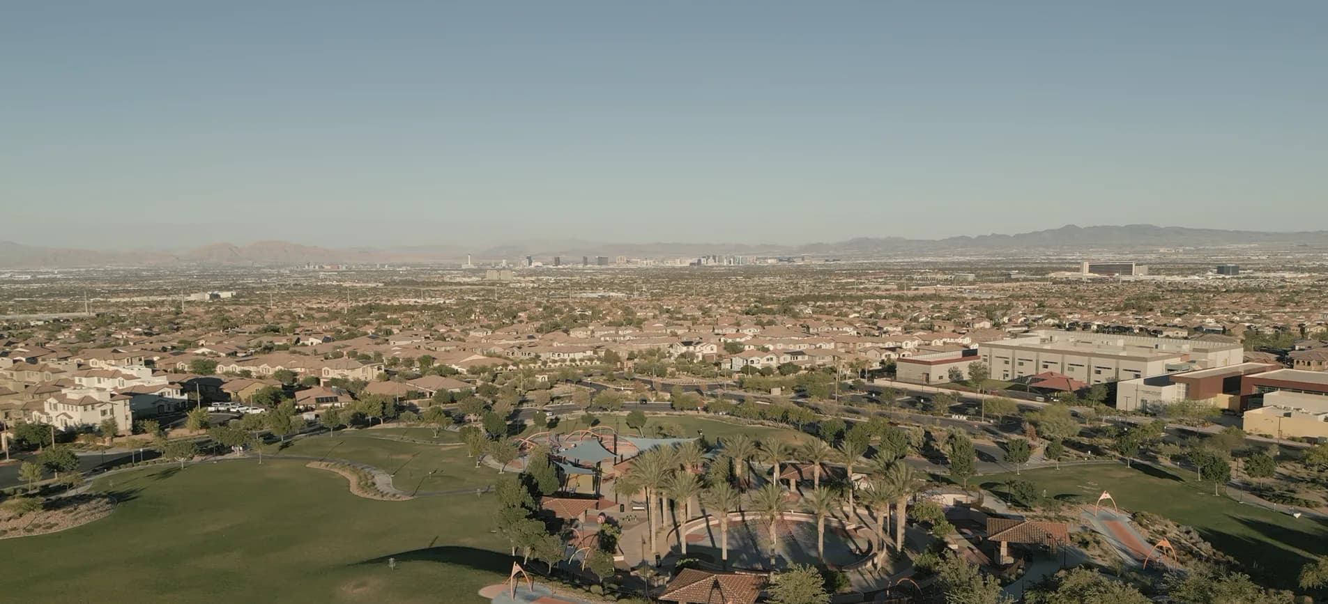
Villages, districts and neighborhoods: the words matter
Three words get used interchangeably in Summerlin conversation, and they mean genuinely different things. Getting them straight will save you a lot of confusion on a new-build tour.
The structure comes from the City of Las Vegas planning process, and it runs in one direction: Summerlin → village → parcel → neighborhood. Summerlin prepares a general development plan covering one or more villages. That gets approved. Then it prepares development plans setting land use and density for individual parcels inside those villages. Then builders build neighborhoods on the parcels. In the City’s own documents the villages are referred to by number before they ever get a name.
So in practice: Summerlin is the whole master plan. Grand Park is a village inside it. A builder neighborhood (twenty to a couple of hundred homes, one builder, one set of floor plans) sits inside Grand Park. When a salesperson says “we’re in Summerlin,” they mean the outermost of those three. That’s true and it’s nearly useless on its own.
The practical version: the village decides your parks, your trails, your commute and your neighbours. The builder neighborhood decides your house and, usually, your sub-association dues. You’ll hear “district” used too, mostly for the newer western areas. Treat it as another word for village unless someone gives you a reason not to.
One more layer worth knowing about: the plan zones land into categories beyond housing: Village Center, Town Center, Employment Center, Neighborhood Focus, Community Open Space. That’s why a village can have a grocery store built into it while the one next door doesn’t, and why Downtown Summerlin exists where it does. It was zoned Town Center decades before it was built.
The villages, one by one
Not every Summerlin village is here, since the community has been adding them for thirty-six years and a few of the smaller ones are grouped together, but these are the names you’ll actually hear, and what separates them from each other.
Downtown Summerlin & Summerlin Centre
Sahara Ave to Charleston Blvd, along the west side of the CC-215
The commercial heart of the community and the village wrapped around it. Downtown Summerlin's greater area covers 400 acres inside Summerlin South; the open-air center at the middle of it is 106 acres.
- Housing
- The densest housing in Summerlin: apartments, townhomes and lower-maintenance attached product, plus single-family closer to Charleston. Summerlin Centre is still selling new homes.
- What makes it different
- The only part of Summerlin where you can park once and spend an evening on foot. Also the only part with a ballpark, an NHL practice rink and a resort casino inside a ten-minute walk.
Worth a look if you want shops, restaurants and events genuinely within walking distance, and you're willing to trade lot size and quiet for it.
The Ridges
Southern Summerlin, west of Town Center Drive
A 793-acre guard-gated custom-home village on a ridgeline at roughly 4,000 feet, built around Bear's Best, a Jack Nicklaus course.
- Housing
- Custom and semi-custom homes on hillside lots, at the very top of the Summerlin price range. Not a tract-home village.
- What makes it different
- Elevation and controlled access. The height buys valley views and, on paper, slightly cooler air than the floor of the valley.
Relevant if you're looking at custom construction or the highest end of the resale market and want a gate between you and the road.
The Paseos
West of the CC-215, south of Far Hills Ave
A 768-acre village on the western side, built out through the 2000s and 2010s, organized around The Paseos Park and the arroyo trail network.
- Housing
- Mostly single-family, a broad range of sizes and ages, with some gated pockets. Landscaping here has had time to grow in.
- What makes it different
- One of the clearest illustrations that Summerlin West is not the same as new construction. It's west of the beltway and it is not new.
Worth a look if you want the western side and Red Rock proximity but would rather buy a finished street than live next to one being built.
The Vistas
West of the CC-215, between Charleston and Far Hills
An established western village with its own community park and pool, sitting between the older core and the newer districts further west.
- Housing
- Single-family and multi-family, largely 1990s and 2000s, with gated and non-gated neighborhoods side by side.
- What makes it different
- Its position. It's close enough to Downtown Summerlin to use it easily, and far enough west that the mountains are the view.
A middle option: western-side location, mature streets, and shorter drives than the newest villages further out.
Stonebridge
The far western edge, south of Charleston Blvd
A newer village on elevated ground hard against the Red Rock Canyon conservation area, about as close to the boundary as the master plan gets.
- Housing
- Newer single-family construction, much of it 2018 onward, on rolling desert-edge terrain.
- What makes it different
- Proximity to Red Rock, and topography. Summerlin describes the first phase of the Red Rock Canyon Legacy Trails project, which would connect cyclists and hikers from here out to the conservation area, as under development. No opening date has been published.
The one to look at if trailhead access is genuinely the reason you're moving west, rather than a line in a brochure.
Redpoint & Redpoint Square
West of the CC-215, around Sky Vista Dr and Desert Foothills Dr
Two adjacent Summerlin West districts. Summerlin describes Redpoint Square as blending contemporary attached and detached homes with walkable streets and open space.
- Housing
- A genuine mix: detached single-family alongside attached and townhome product, at higher density than older Summerlin villages.
- What makes it different
- Density and street design. This is Summerlin trying something more urban than the 1990s village pattern, on the western side.
Worth seeing if you want new construction and don't need a large lot, and if you want to compare an attached home against a detached one on the same street.
Kestrel & Kestrel Commons
Northwest Summerlin, west of the beltway
Two more paired districts. Summerlin puts Kestrel at over 3,000 feet; Kestrel Commons, just south, is the denser, more walkable half of the pair.
- Housing
- Kestrel is single-family with view lots; Kestrel Commons runs to contemporary attached and detached homes. Both are actively selling.
- What makes it different
- Elevation, and the contrast between the two halves. It's a useful place to see how differently one Summerlin name can be built out.
Relevant if you're shopping new construction and want to compare view lots against lower-maintenance product without leaving one area.
Grand Park
West of the 215 Beltway, north of Far Hills Ave
One of the newest villages, named for the more-than-90-acre park at the middle of it, the largest park in Summerlin, opening in three phases.
- Housing
- Actively building, with several builders working at once across single-family and attached homes.
- What makes it different
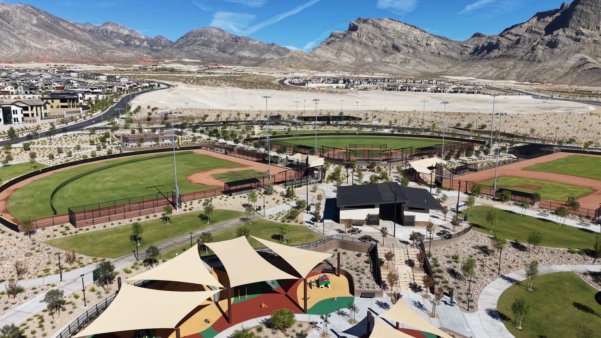
- The park. Phase one opened in early 2026 with ballfields, courts, a splash pad and a playground; two further phases are still in planning.
Worth a look if a large park at the center of the village matters to you, and if living beside active construction for a few years doesn't.
La Madre Peaks
The far northwest, at the base of the La Madre range
The newest western frontier of the master plan, including Astra, a custom-homesite enclave of 167 homesites across 171 acres that debuted in 2025.
- Housing
- Custom homesites alongside builder neighborhoods, at the high end and at the highest elevations in the community.
- What makes it different
- It's the edge. Beyond it is conservation land, which is the whole reason this is where the master plan is finishing rather than starting.
For custom-home buyers, and for anyone who wants to understand what Summerlin's last chapter is going to look like.
The Trails, The Arbors, The Canyons, The Crossing, The Pueblo & The Hills
East of the CC-215, north of Charleston Blvd
The established core. The Hills was Summerlin's first village in 1990 at 394 acres; The Arbors runs to 1,206, The Canyons 754 and The Trails 573.
- Housing
- Predominantly 1990s and early-2000s single-family, with custom pockets, guard-gated enclaves and multi-family mixed in. Resale only.
- What makes it different
- Tree canopy. This is the part of Summerlin where thirty years of irrigation has actually produced shade, which is not a small thing here.
The answer for anyone who wants a finished, grown-in street and doesn't need the house to be new.
Sun City Summerlin
The northern end, around Del Webb Blvd and Rampart
Del Webb's age-restricted community inside Summerlin, with its own architectural review committee separate from the rest of the master plan.
- Housing
- Age-restricted (55+) single-family homes, attached homes and condos, with their own golf courses and community facilities.
- What makes it different
- It runs under its own rules. The Summerlin Development Standards carve out separate review for the Del Webb retirement villages.
Only relevant if you qualify for age-restricted housing, but worth knowing it exists, because it shapes the northern end of the community.
The Willows, The Gardens, Siena, The Mesa & The Cliffs
Southern Summerlin, from Flamingo down past Russell Rd
The southern villages, running one below the next. The Willows covers 731 acres; The Cliffs, at just over 418 acres and nine neighborhoods, is Summerlin's southernmost village.
- Housing
- The Willows, The Gardens and Siena are established resale; The Mesa and The Cliffs are newer, and sit on land Summerlin only acquired in a 2002 exchange with the BLM.
- What makes it different
- How far south Summerlin actually reaches. The Cliffs is below Russell Road, south of where most people assume the community stops.
Worth a look if you want a Summerlin address with a shorter run to the southwest valley and the airport side of town.
Several of these deserve their own full guide, and will get one. Until a guide is actually written the name stays plain text rather than a link. No dead ends. Acreages and village descriptions come from Summerlin’s own published materials; the read on what each one is like is mine.
What it actually feels like to drive
Drive from the eastern edge of Summerlin out to La Madre Peaks and you cross about thirty-six years of construction in twenty minutes. Here’s what changes on the way.
The trees disappear. This is the single most reliable tell. The older villages have mature canopy: real shade over the sidewalk, which in this climate is worth more than any amenity a brochure lists. The newest villages have staked saplings in gravel. That gap is fifteen to twenty-five years wide, and no amount of money closes it faster.
The ground starts moving. East of the beltway you’re essentially on the valley floor, on a grid. West of it the land climbs (Summerlin puts Kestrel above 3,000 feet and The Ridges around 4,000) and the streets start following arroyos and contours instead of section lines. You feel it in the driveways, the retaining walls and the view out of the back window.
The walls change character. Perimeter village walls are a Summerlin signature, and the standards for them are written differently west of the 215. Taller walls and rockery retaining are permitted out there because of the terrain. It reads as a more dramatic, more sculpted streetscape, and also as a more enclosed one.
The density swings hard. Around Downtown Summerlin there are apartments over retail and townhomes on small lots. Twenty minutes away there are 171 acres divided into 167 custom homesites. Both are Summerlin. The distance between those two propositions is bigger than the distance between Summerlin and most other parts of the valley.
And the further west you go, the further everything gets. The trailhead gets closer and everything else gets further: the grocery run, the school run, the airport, the friend who lives in Henderson. That trade is the whole decision on the western side, and it’s worth making it deliberately rather than discovering it in March.
The constant through all of it is the beltway. Almost every trip in Summerlin that isn’t within your own village involves getting to the CC-215 or crossing it, which is why two years of construction on it is a bigger deal here than the same work would be somewhere with more ways out.
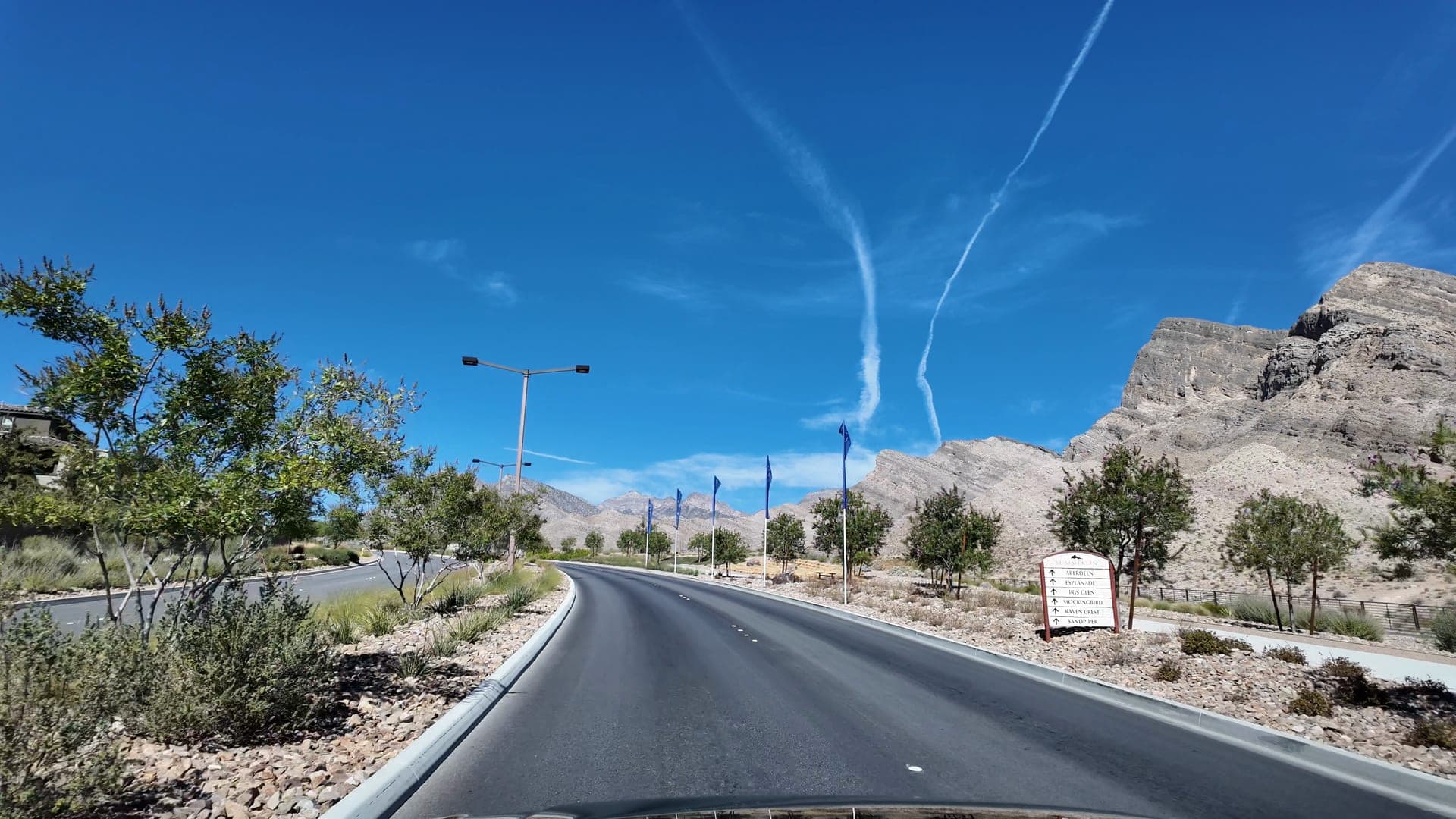
Summerlin’s villages were built over thirty-six years. You can read the decade off the trees.
Downtown Summerlin, and what it isn't
Start with the correction, because it catches people relocating from out of state every week. Downtown Summerlin is not downtown Las Vegas. Downtown Las Vegas is the historic city center: Fremont Street, the courthouses, the Arts District. It’s about nine miles east. Downtown Summerlin is a purpose-built commercial district that opened in 2014. Same word, different centuries.
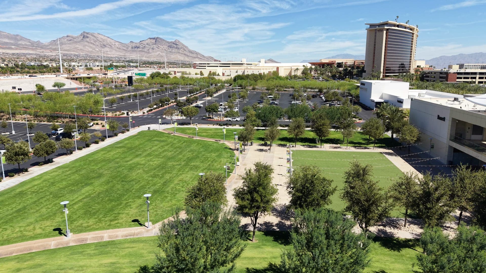
What it is: a 400-acre district inside Summerlin South, bounded by Charleston on the north, Sahara on the south, the beltway on the west and Town Center Drive on the east. At the middle of it sits a 106-acre, 1.6 million square foot open-air center with more than 125 shops, bars and restaurants, anchored by Dillard’s and Macy’s. It opened on 9 October 2014.
Around and inside it: Red Rock Resort, which actually predates the shops (it opened in April 2006); City National Arena, the Vegas Golden Knights’ practice facility and headquarters, open since 2017 and also home to UNLV hockey; and Las Vegas Ballpark, where the Triple-A Aviators have played since 2019. Then a stack of offices that has grown steadily: One Summerlin, Two Summerlin, 1700 Pavilion, and most recently Meridian, a 147,602-square-foot class-A campus that opened in 2025 with Google Fiber among its tenants.
The distinction that actually matters to you
Every Summerlin listing mentions Downtown Summerlin. Almost none of them distinguish between having it in your community and being able to walk to it. The number of Summerlin homes within a genuine walk is small: the apartments and attached homes in Summerlin Centre, a few streets either side. Everyone else drives, parks, and then walks around, which is a perfectly good evening and a completely different thing from walkability.
If walking to dinner is genuinely the point for you, that narrows Summerlin to a handful of streets, and it’s worth saying so out loud before you start looking. If driving eight minutes to a good evening is fine (and for most people it is) then having Downtown Summerlin in the community is a real advantage that most of the valley doesn’t have.
Summerlin West: what's actually happening out there
“Summerlin West” is the term you’ll hear most from builders and agents, and the one most likely to be misunderstood. Two corrections up front.
First: it’s a region, not a subdivision. Nobody lives “in Summerlin West” the way they live in Stonebridge. It covers roughly everything west of the CC-215, a usage the City of Las Vegas echoes when its Summerlin standards write separate rules for “areas west of the 215 Beltway.” It also has a formal origin: 8,318 acres annexed under a 1997 development agreement and described in the City’s own documents as the Summerlin West area.
Second: it doesn’t mean new. The Vistas and The Paseos are both west of the beltway and both were built out years ago, with grown landscaping and finished streets. Stonebridge started later. Redpoint, Kestrel, Grand Park and La Madre Peaks are the genuinely current ones. So “we’re looking in Summerlin West” could mean a 2005 home under mature trees or a 2026 home with a construction fence at the end of the block. Those are not the same search.
Where the growth is right now
The active frontier runs north and west. Redpoint and Redpoint Square brought a denser, more walkable street pattern than the classic 1990s village layout. Kestrel and Kestrel Commons repeat that contrast at higher elevation. Summerlin puts Kestrel above 3,000 feet. Grand Park, west of the beltway and north of Far Hills, is organized around a park of more than 90 acres, the largest in the community. La Madre Peaks is the outer edge, including Astra, a custom-homesite enclave of 167 lots across 171 acres that debuted in 2025.
Summerlin closed 2025 with ten new neighborhoods and has said it expects eleven more in 2026, nearly all of them out here. Howard Hughes puts roughly 5,000 gross acres as still reserved for future growth. That’s its own figure, and one that explicitly includes roads, open space and common areas rather than only future rooftops. (Summerlin’s history page gives a materially smaller number for 2023; the two don’t reconcile and I’m not going to pretend to know which basis is right.)
What buying out here actually involves
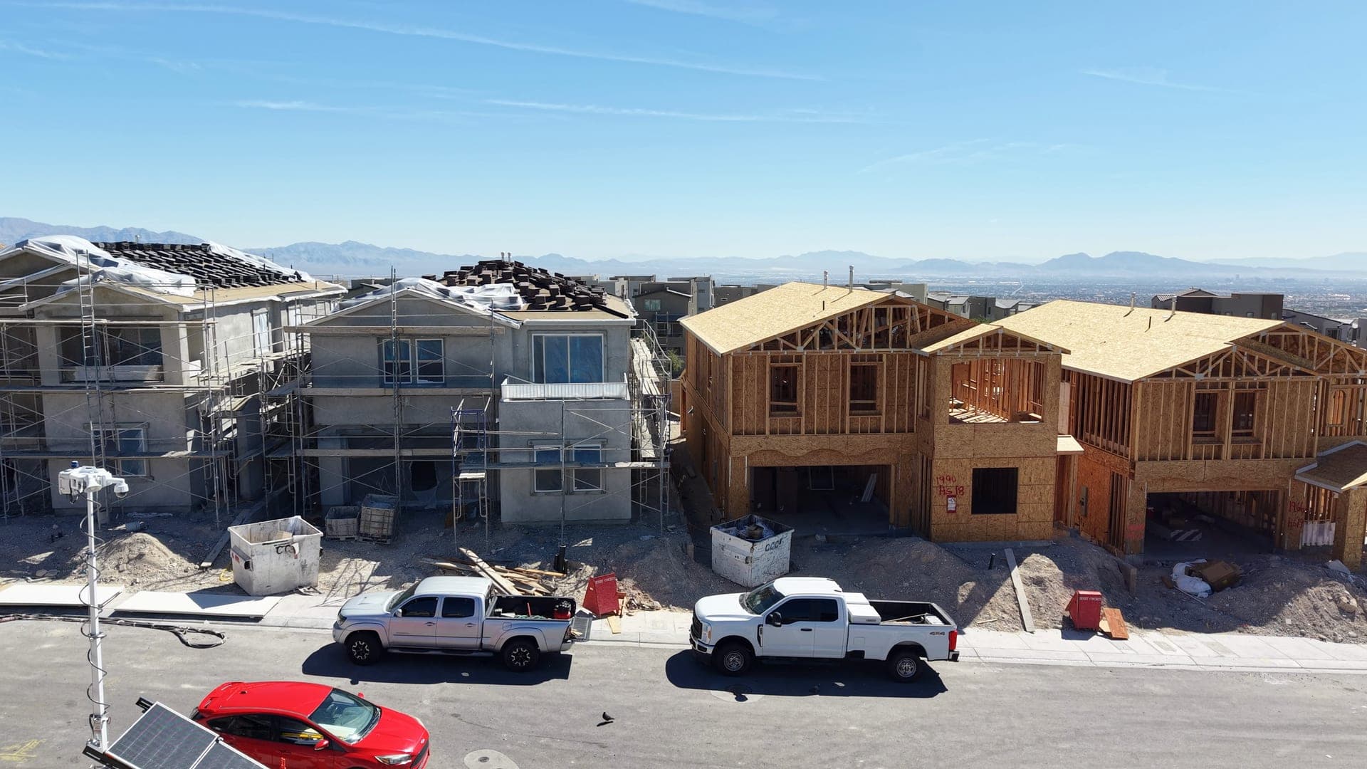
Newer house, better view, higher ground, and years of living next to construction. Dirt haulers on your street. A park that opens in phases. Retail that is promised and not yet built. Roads that change alignment. That’s not a warning so much as a description. It’s what an unfinished village is, and plenty of people happily accept it for the house and the view they get.
The thing that does deserve a warning: find out what’s planned for the empty land near the house before you commit, not after. Out here the vacant parcel across the street is not a permanent feature. It’s a scheduled one.
Summerlin Development Watch
Updated August 2026
Summerlin changes faster than most pages about it can keep up with, and a lot of what you’ll find searching is a rendering from three years ago. Here’s where things actually stand, split by what’s genuinely open, what’s genuinely being built, and what has only been announced. Every status below is sourced, and if I couldn’t verify which of the three a project was in, it isn’t here.
Open now
Built, operating, and something you can go stand in today.
Grand Park: phase one
Open1001 Kettle Ridge Dr, off W Sky Vista Dr, Grand Park village
The first of three phases of what will be a more-than-90-acre park, Summerlin's largest. Open now with ballfields, pickleball and basketball courts, a playground, a splash pad, shaded picnic areas and a concession building.
Phases two and three have not opened and have no published schedule. Summerlin has not published a completion date for the full park.
Status via Las Vegas Review-Journal, 30 March 2026
Council Park and The Hub
OpenGrand Park village and Kestrel Commons
Two smaller parks that opened during 2025, alongside the final phase of the Redpoint Arroyo and Kestrel Creek Arroyo trail corridors. These are the amenities that arrive before the neighborhoods around them finish.
Status via Summerlin, 2025 year in review
Meridian office campus
OpenAdjacent to the CC-215 at Town Center Drive
A three-story, 147,602-square-foot class-A office campus, opened in 2025 with Eide Bailly and Google Fiber as tenants. Part of a slow shift that has made Summerlin somewhere people work, not only somewhere they drive home to.
Status via Summerlin, 2025 year in review
Roseman University College of Medicine
OpenRoseman University's Summerlin campus
A new medical school that welcomed its first MD class in July 2025 after receiving preliminary LCME accreditation in February 2025. Its practical effect on the area is traffic, housing demand and a steady institutional employer.
Status via Nevada Business Magazine, February 2025
Under construction
Ground has actually been broken. Dates still move.
CC-215 / Summerlin Parkway interchange
Under constructionCC-215 between Far Hills Ave and W Lake Mead Blvd
A $130 million Clark County rebuild of the interchange: reconfigured ramps, a new flyover from southbound CC-215 to eastbound Summerlin Parkway, new and widened bridges, and three new trail bridges carrying the City of Las Vegas Trail across the beltway. Work started 10 February 2025 on a three-year schedule. Expect lane restrictions, ramp closures and a 55 mph work zone on the road most of Summerlin uses to leave.
Reporting has put completion around 2028. The county has not published a firm finish date, so treat any specific one you see with suspicion.
Status via Clark County
CC-215 widening, Charleston Blvd to Far Hills Ave
Under constructionCC-215 past Downtown Summerlin
A $73.5 million Clark County project adding a lane in each direction, plus a braided ramp from northbound CC-215 to Charleston and new ramps giving Summerlin Centre Drive direct freeway access. It appears on the county's projects-in-construction list. Reporting put the start at summer 2026 and the duration at roughly 18 months. Clark County's project page was publishing biweekly lane-restriction notices covering late September through 24 October 2026, so work is under way.
This runs concurrently with the interchange rebuild immediately north of it. Two overlapping projects on the same freeway is the single most useful thing to know about driving here right now.
Status via Clark County projects in construction
New neighborhoods across Summerlin West
Under constructionGrand Park, Kestrel, Kestrel Commons and La Madre Peaks
Summerlin closed 2025 with ten new neighborhoods and said it expects eleven more in 2026, almost all of them west of the beltway, including Astra at La Madre Peaks, a custom-homesite enclave of 167 homesites across 171 acres.
Individual neighborhood names and openings move constantly. Summerlin's actively-selling list is the only version worth trusting on the day you read it.
Status via Summerlin, 2025 year in review
Planned or proposed
Announced, approved, or designed, but not built. Treat renderings accordingly.
Grand Park: phases two and three
PlannedGrand Park village
The rest of the 90-acre park. Coverage of the phase-one opening in March 2026 described the remaining phases as still to come, with no schedule attached. Phase one itself is roughly 22 acres, so most of the park is not built yet.
No opening date or design for phases two and three has been published that we could find.
Status via Hoodline, 30 March 2026
354 apartments off Sahara at the beltway
PlannedSpruce Goose Street, just east of the Downtown Summerlin center
A Howard Hughes proposal for a five-story, 354-unit apartment building with a parking structure and about 6,556 square feet of commercial space on a site of nearly four acres. That's more density immediately around Downtown Summerlin.
Proposed only as far as we can confirm. Clark County commissioners were scheduled to consider it on 2 September 2026, but we could not find a report of the outcome when this page was re-checked on 19 October 2026.
Status via Las Vegas Review-Journal, 14 August 2026
Red Rock Canyon Legacy Trails
PlannedFirst phase begins near Sky Vista Dr, running toward the Red Rock Visitor Center
A Clark County project to connect cyclists and hikers from the Summerlin village of Stonebridge out to Red Rock Canyon. Summerlin describes the 5.5-mile first phase, which begins near Sky Vista Drive and links to the Red Rock Visitor Center, as under development. Once it's usable, it changes what 'close to Red Rock' actually means for the western villages.
Summerlin's wording is 'under development,' not 'open' and not a construction milestone. We could not find a published construction start or completion date, so it stays in this group until the county confirms one.
Status via Summerlin, on the trail system
The two freeway projects are the ones to pay attention to if you’re shopping here this year. They overlap on the same stretch of the CC-215, and that’s the road most of Summerlin uses to leave. Clark County’s projects-in-construction list is the live version. For new neighborhoods, Summerlin’s own actively-selling list is the only one worth trusting on the day you read it. Statuses were checked on 20 August 2026, and the Grand Park, Red Rock trail, freeway and Spruce Goose apartment entries were re-checked on 19 October 2026. All of it will move.
Parks, trails and Red Rock
This is the part of Summerlin that lives up to the brochure, so it’s worth being precise about what you actually get and where.
The numbers, from Summerlin: more than 300 parks, of which nearly 40 are major community parks ranging from five to ninety acres, and more than 200 miles of interconnected trails with an eventual target above 250. What makes that work isn’t the mileage, it’s that the trails were designed into the arroyos between villages rather than added afterwards, so a walk to the park often doesn’t involve an arterial road, which is genuinely rare in this valley.
Not all of it is one kind of path, either. Summerlin distinguishes street-side trails, village trails through natural arroyos, ten-foot multi-modal trails, urban trails that separate bikes from pedestrians, regional trails connecting to public land, and natural earthen hiking tread. Which of those you actually have depends on your village, and the newest villages are still growing theirs.
And then there’s Red Rock
Red Rock Canyon National Conservation Area is federal land managed by the Bureau of Land Management, designated in 1990, the seventh NCA in the country and the first in Nevada. It carries a thirteen-mile scenic drive and takes more than three million visitors a year. It is also the western boundary of Summerlin, and the reason the master plan stops where it does rather than continuing into the hills.
Two honest caveats. First, proximity is not evenly distributed. From Stonebridge or La Madre Peaks the conservation area really is close enough to change your weekends. From The Willows or The Hills, Red Rock is a drive, a shorter one than from most of the valley, but a drive. Summerlin is thirty-five square miles; not every home has Red Rock out the back.
Second, the scenic drive requires a booking. From 1 October through 31 May you need a timed-entry reservation to drive the loop between 8am and 5pm. Trailheads outside the fee area work differently, but the spontaneous Saturday-morning drive up the canyon is a summer thing. Worth knowing before you buy a house for the view of somewhere you need to reserve.
Something to watch: the Red Rock Canyon Legacy Trails project would connect cyclists and hikers from Stonebridge out toward the Red Rock visitor center, with a 5.5-mile first phase. Summerlin describes that phase as “under development,” but no opening date has been published, so don’t buy on the assumption that the trail exists yet. Once it does, it changes what “close to Red Rock” means on the western side.
What the housing is actually like
Summerlin has a reputation as the expensive option, and on average that’s fair. But “luxury” as a description of the whole community is wrong, and it costs people money, either by scaring them off before they look, or by getting them shown the wrong quarter of it.
The range is enormous. Inside one master plan you have age-restricted condos, apartments over retail at Downtown Summerlin, attached townhomes in the newer western districts, thirty-year-old single-family homes on grown-in streets, brand-new production homes, golf-course frontage, guard-gated enclaves and custom homesites sold by the acre. Ten golf courses. Twenty-six public, private and charter schools inside the community.
Resale versus new is a real fork. The established villages are resale only, and what you buy there is a finished street, mature landscaping and a house that’s twenty to thirty-five years old. The western villages are where the new construction is, and what you buy there is current spec, a warranty, and a few years of living inside a construction site. Both are legitimate. They’re priced differently for reasons that have nothing to do with which is better.
Gates and golf shape whole villages. Guard-gated is common at the upper end: The Ridges, Willow Creek inside The Willows, and others. Golf courses anchor their own housing markets across the community, including TPC Las Vegas in The Canyons and Bear’s Best in The Ridges. And Sun City Summerlin operates as age-restricted housing with its own architectural review committee, separate from the rest of the plan.
Expect at least two layers of association, and check both. Summerlin has a master association covering community-wide standards and amenities, and most neighborhoods add a sub-association on top. Some add a gate, a private club or a golf membership structure as well. The total varies enormously between villages and between neighborhoods inside one village. Ask for the actual figure on the actual address, not a range. Design review is real here too: exterior changes go through committee. Most people consider that a feature; some find it out the hard way.
On prices, and why there isn’t a number here
I’m not going to publish an “average Summerlin home price.” You’ve just read that this one community contains both age-restricted condos and custom homesites at 4,000 feet. A single median across that range describes nothing. It moves depending on whether whoever calculated it included Downtown Summerlin apartments, or The Ridges, or the new-build closings out west, and almost nobody says which they did.
What is worth reading is the valley-wide figure, which I keep current in the monthly market read, and a concrete walkthrough of what a specific budget buys in the $500K guide. For Summerlin specifically, the honest answer is a conversation against current listings in the village you’re actually considering.
The tradeoffs
Summerlin is a good answer for a lot of people. Here’s what you’re trading for it, without manufacturing complaints to look balanced.
You generally pay more. Not uniformly, and not in every village, but as a broad pattern Summerlin costs more than comparable housing elsewhere in the valley. Some of that is the amenities and the standards; some of it is the name.
You are buying into a governed environment. Master association plus sub-association, design review, standards on walls and landscaping. That’s precisely what keeps Summerlin looking the way it does thirty-six years in. It also means the community has an opinion about your front yard.
Consistency reads as calm to some people and as sameness to others. The coordinated walls, the coordinated palette, the coordinated landscaping. It’s genuinely restful, and it’s genuinely repetitive. Nobody can tell you in advance which way you’ll take it. Drive three villages and you’ll know.
The far west adds real driving time. Every mile toward Red Rock is a mile away from the airport, the Strip, the medical district and anyone you know on the other side of town. If your life is anchored east, with an office off the Strip or family in Henderson, do that arithmetic honestly before the sunsets do it for you.
Walkability is a pocket, not a property of the place. Outside Summerlin Centre and a couple of the newer western districts, this is a drive-everywhere community with excellent trails for recreation. Trails are not errands.
And right now, there’s the freeway. Two concurrent Clark County projects on the CC-215 through Summerlin, one of them a three-year interchange rebuild. It will be better afterwards. It is not better now, and anyone selling you on the commute this year should be mentioning it.
Summerlin vs Southwest Las Vegas
The two big new-construction answers on this side of the valley, and the comparison people make most often. No scores, because there isn’t honest data to score these on. Just which way each dimension leans and why.
- One coordinated plan you can feel from the streetThirty-six years of one developer working to one set of standards, versus dozens of builders filling in a stretch of county.
- Leans towardSummerlin
- A recognizable commercial and entertainment centerDowntown Summerlin has a ballpark, an arena and 125-plus shops. The Southwest's answer, UnCommons, is newer and much smaller.
- Leans towardSummerlin
- Genuine trailhead access to public landRed Rock Canyon is the western boundary. Nothing in the Southwest sits against a national conservation area.
- Leans towardSummerlin
- Housing outside a master planLarge-lot pockets, independent builder tracts and horse property all exist there. Inside Summerlin, essentially everything is inside the plan.
- Leans towardSouthwest
- More house for the moneyA broad, general pattern rather than a rule, and one worth testing against live listings rather than taking from a page.
- Leans towardSouthwest
- Freeway accessBoth hang off the CC-215. Summerlin also has Summerlin Parkway to US-95; the Southwest has I-15 on its eastern side.
- Leans towardBoth
- Getting to the Strip and the airportSimple geography: the southwest valley is closer to both. Summerlin sits about nine miles west of the Strip before you account for traffic.
- Leans towardSouthwest
- Active new constructionSummerlin's is concentrated on its western edge inside one plan. The Southwest's is scattered across infill parcels all over the area.
- Leans towardBoth
- Knowing what you're buying into years from nowThe master plan is public and the land use is set. Southwest vacant parcels are a genuinely open question.
- Leans towardSummerlin
The short version: Summerlin is one plan executed over thirty-six years, and you can feel the plan from the street. The Southwest is many separate developments that filled the same stretch of county over the same decades, next to each other rather than with each other. You trade cohesion, trails and a real center for more variety, frequently more house, and a shorter run to the airport side of town. The Southwest guide is the honest version of the other side.
Summerlin vs Henderson
People put these two head to head constantly, and the comparison is shakier than it looks, because they aren’t the same kind of thing. Summerlin is one master-planned community. Henderson is an incorporated city. Henderson has its own mayor, council, police department and parks department, and it contains dozens of very different communities: new master plans, a historic downtown, hillside estates, a lake. Comparing a community to a city means you’re comparing a specific thing to an average of many things.
The useful comparison is Summerlin against a specific Henderson community: Green Valley, Anthem, Inspirada, Lake Las Vegas, Cadence. Those are apples to apples. “Summerlin or Henderson” usually turns out to mean “west side or southeast side,” which is really a question about where your work and your people are.
Geographically they sit at opposite corners: Summerlin against the mountains on the west, Henderson across the bottom-right of the valley toward Lake Mead. The full Summerlin vs. Henderson comparison goes through it properly, and the Henderson guide breaks the city down community by community, which is the only sensible way to think about it.
Summerlin, Henderson or Southwest?
These three come up in almost every relocation conversation, and they're not three versions of the same thing. One is a master-planned community, one is a whole city, and one is an informal name for a stretch of county. This comparison walks through how differently they actually feel to live in.
Filming now. The video lands on this page when it publishes.
Summerlin, answered
The questions people actually type in, answered as precisely as the facts allow, which sometimes means answering “it depends,” and saying why.
What is Summerlin, Las Vegas?
- A master-planned community on the western edge of the Las Vegas Valley, developed by Howard Hughes across 22,500 acres, roughly 35 square miles. Development started in 1990 with a single village and has continued village by village ever since; 2026 is its 36th year. It is a community, not a municipality.
Is Summerlin a city?
- No. Summerlin has no city government, no mayor and no police department of its own. Most of it sits inside the City of Las Vegas, where it is a PC (Planned Community) zoning district with its own development standards adopted by the City Council. The southern end falls under Clark County instead. Which one covers a specific address decides who you call about a permit or a pothole.
Is Summerlin part of Las Vegas?
- Mostly yes, in the legal sense. The land was annexed to the City of Las Vegas beginning in November 1989, with a further 8,318 acres known as Summerlin West annexed under a 1997 development agreement. In everyday speech people treat Summerlin as its own place, and that’s fine. Just don’t assume it means a separate government.
Where does Summerlin begin and end?
- There is no public boundary line to point at. Summerlin is a private master plan, so its extent is defined by the developer’s own plan rather than by any government map. Summerlin publishes an official border map, and that is the authority. What you can navigate by is the geography: Red Rock Canyon conservation land is the hard western limit, the community runs roughly from the Lone Mountain area down past Russell Road, and the CC-215 runs through the middle of it.
Is Summerlin defined by ZIP codes?
- No, and Summerlin says so itself: “our community is defined by our official boundaries, not by zip code.” The ZIPs most often associated with it are 89134, 89135, 89138 and 89144, and the community also extends into 89148, but plenty of homes in those ZIPs are not in Summerlin, and a few Summerlin neighborhoods sit outside the usual four. If it matters to you, check the address against Summerlin’s border map rather than the envelope.
What is Summerlin South?
- It has a specific planning meaning, and it is narrower than “the southern bit of Summerlin.” Summerlin South is a Clark County land-use planning area of about 7,099 acres, which the county describes as generally bounded by Charleston Boulevard on the north, Russell Road on the south, Hualapai Way on the east and the Red Rock conservation area on the west. There is also a Summerlin South census-designated place, which is a different geography again. Neither is simply a synonym for every southern Summerlin neighborhood.
What is Summerlin West?
- In everyday use, the part of Summerlin west of the CC-215, a usage the City of Las Vegas standards echo when they write rules for “areas west of the 215 Beltway.” It also has a formal origin: 8,318 acres annexed under a 1997 development agreement and described in the City’s own documents as “the Summerlin West area.” It is a region, not a subdivision, and it is not a synonym for new construction. The Vistas and The Paseos are west of the beltway and were built years ago.
Is Downtown Summerlin the same as Downtown Las Vegas?
- No, and they’re about nine miles apart. Downtown Summerlin is a 400-acre commercial district off Sahara Avenue at the beltway, opened in 2014, with a 106-acre open-air center at the middle of it. Downtown Las Vegas is the historic city center: Fremont Street, the courts, the Arts District. Different places, different eras, entirely different feel.
How far is Summerlin from the Strip?
- Howard Hughes describes the community as sitting about nine miles west of the Strip, and that’s a fair number for the middle of it. But Summerlin is 22,500 acres, so one drive time can’t be true for all of it: a home in the southern villages and a home at La Madre Peaks are not the same trip, and neither is the same at 8am as at 8pm. There are also two Clark County construction projects running on the CC-215 through Summerlin right now. Drive the route you’d actually drive, at the hour you’d drive it.
Is Summerlin still being built?
- Yes, and mostly on its western side. Summerlin listed seven villages as actively selling new homes in August 2026 (Grand Park, Kestrel, Kestrel Commons, La Madre Peaks, Redpoint Square, Summerlin Centre and The Peaks) and closed 2025 with ten new neighborhoods. Howard Hughes says roughly 5,000 gross acres remain reserved for future growth, a figure that includes roads, open space and common areas rather than only future homes.
What's the difference between Summerlin and Southwest Las Vegas?
- Structure. Summerlin is one master plan, run by one developer, with published standards and a defined extent. Southwest Las Vegas is an informal name for a large stretch of unincorporated Clark County with no boundary at all, filled in by many separate builders over the same decades. They can produce similar-looking houses and a very different experience of the place around them.
Is every home near Red Rock Canyon?
- No, and this is the claim to be most careful with. Red Rock Canyon is Summerlin’s western boundary, so the western villages genuinely are close to it. From the eastern and southern villages you are still driving, and from October through May the scenic drive requires a timed-entry reservation booked in advance. Proximity to Red Rock is a real Summerlin advantage; it is not evenly distributed across 22,500 acres.
So should you look here?
Look at Summerlin if you want the trails and the parks used properly, if a coordinated, well-maintained environment appeals to you rather than bores you, if being close to Red Rock genuinely changes your weekends, and if you’re comfortable paying something for all of that. It’s the most complete version of that idea in this valley, and thirty-six years of consistency is not nothing.
Look elsewhere if you want a neighborhood with history and an unplanned center, if you want the most house per dollar, if your life is anchored on the east or south side of the valley, or if design review on your own front yard would irritate you. The Arts District is the opposite instinct entirely, and Southwest is the less curated version of the same suburban idea.
And if you are looking here, do the thing this whole page has been asking you to do. Pick three villages that sound different from each other. Drive all three on the same afternoon, in that order, ending with the newest one. You’ll feel the thirty-six years in about ninety minutes, and you’ll know which decade of Summerlin you actually want to live in. That’s a much better question than whether you want Summerlin.
Photographed over Summerlin by Mikey Del Rosario. Development status (what’s open, under construction, or only announced) was checked on 20 August 2026 and partly re-checked on 19 October 2026, and will change; check with Summerlin, the builders or Clark County before planning around it.
Sources & updates · Checked 20 August 2026; partly re-checked 19 October 2026
- Howard Hughes: Summerlin community overviewAcreage (22,500), current population, remaining acres reserved for growth, and the nine-miles-from-the-Strip figure.
- Summerlin: community historyThe 1952 Hughes land purchase, the 1988 naming and BLM land exchange, the first village in 1990, the 2002 exchange that extended the southern edge, and Downtown Summerlin's 2014 opening.
- Summerlin: defined by boundaries, not ZIP codesSummerlin's own statement on boundaries versus ZIP codes, the ZIPs associated with the community, and that Red Rock Country Club is not part of the master plan.
- Summerlin: villages currently sellingWhich villages were actively selling new homes when this page was checked, and how Summerlin describes each of them.
- Summerlin: 2025 year in review2025 neighborhood, park and office openings, Downtown Summerlin retail additions, and the outlook for 2026.
- Summerlin: parks and the trail systemTrail mileage now and planned, the six trail types, the Summerlin Parkway trail segment, and the Red Rock Canyon Legacy Trails project.
- City of Las Vegas: Summerlin Development Standards (revised October 2025)Summerlin's PC zoning status, the Husite origin, the 1987 plan and 1989 annexation, the 1997 annexation of 8,318 acres as Summerlin West, the land-use hierarchy, and the village-to-parcel-to-neighborhood planning process.
- Clark County Comprehensive Planning: Summerlin SouthThe Summerlin South planning area: 7,099 acres, its stated boundaries, and the 1995 guide updated in 2005.
- Clark County: CC-215 / Summerlin Parkway interchange projectThe $130 million interchange rebuild: scope, limits, February 2025 start and three-year schedule.
- Clark County: projects in constructionConfirming the CC-215 Charleston-to-Far Hills widening is in construction rather than only announced.
- Bureau of Land Management: Red Rock Canyon National Conservation AreaThe 1990 designation, the 13-mile scenic drive, annual visitation, and that it is federal land managed by the BLM.
- BLM: Red Rock Canyon scenic drive timed entryThe timed-entry reservation requirement from 1 October to 31 May.
- OpenStreetMapRoad centerlines, the Red Rock Canyon conservation-area boundary, and the village coordinates plotted on the LVINIT Summerlin map. © OpenStreetMap contributors, made available under the Open Database License.