- What it is
- A locally used name for a large chunk of the southwest valley. Not a city, not an official neighborhood.
- Known for
- Housing variety, newer construction, established pockets in between, and a lot of active building.
- Major corridors
- 215 Beltway · Durango · Fort Apache · Rainbow · Blue Diamond
- Areas you'll hear about
- Mountain's Edge · Rhodes Ranch · Nevada Trails · Enterprise · Southern Highlands · the Durango corridor
Las Vegas Area Guide
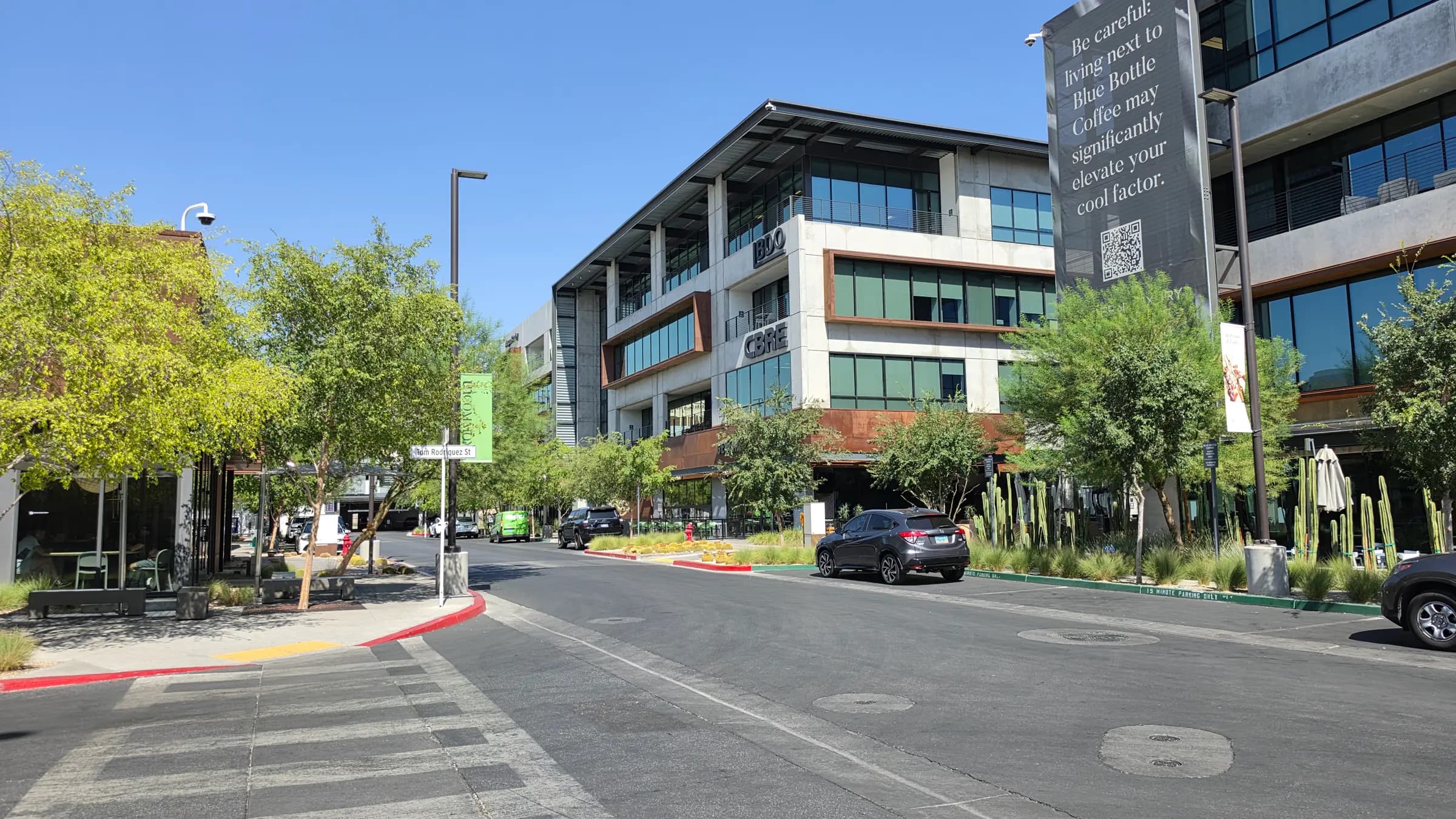
Drive the southwest valley on a weekday morning and you'll notice the same thing I do: almost none of it looks old. The walls are still tan, the trees are still short, and every few blocks there's a corner that was dirt a couple of years ago and is now framing lumber. This is the part of Las Vegas that is still being finished.
It’s also the part people get most confused about, and the confusion starts with the name. “Southwest Las Vegas” isn’t a place any government recognizes. It’s shorthand for master-planned communities and 1990s subdivisions, larger-lot pockets and apartment corridors, finished streets and half-built ones, all sitting next to each other across a big piece of the valley. This guide is my attempt to tell you what locals actually mean by it, where the lines roughly fall, and what you’d be signing up for.
Southwest Las Vegas Map
Where exactly is Southwest Las Vegas?
There isn’t an official answer, so this is mine. The dashed outline is the area essentially everyone means when they say Southwest: roughly Russell Road down past Blue Diamond, and Hualapai across to about Decatur, with the 215 Beltway curving through the middle of it.
The lighter dotted outline is the part people argue about: Southern Highlands down against I-15, and the overlap with Spring Valley up north. I’ve drawn both because pretending there was one clean boundary would be the single most misleading thing this page could do.
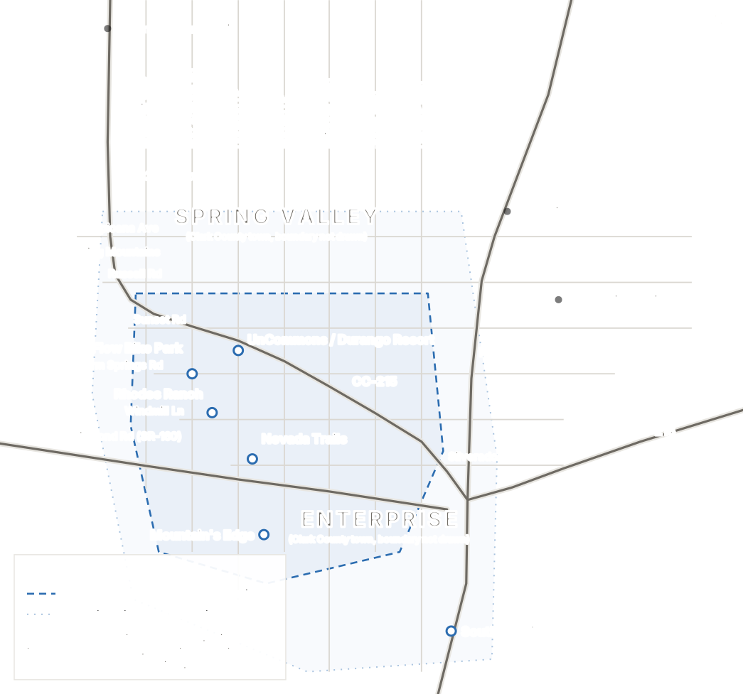
What's on this map
- The CC-215 Beltway
- Runs down the west edge of the valley and then curves southeast through the middle of the Southwest. Almost everything here is oriented to it.
- I-15
- The eastern edge, more or less. When people say Southwest they generally stop at the freeway.
- Blue Diamond Road (SR-160)
- The diagonal. It leaves I-15 heading west-northwest toward the town of Blue Diamond and Pahrump, cutting across the grid.
- Durango, Fort Apache and Rainbow
- The three north-south arterials people use as shorthand for where they live out here.
- Enterprise and Spring Valley
- The two unincorporated Clark County towns most of this area actually sits in. Labeled here, not outlined. See the note below.
- Mountain's Edge
- The big master plan at the southwest corner, south of Blue Diamond and west of Rainbow.
- Rhodes Ranch and Nevada Trails
- Neighboring communities in the middle of the area, either side of the Durango–Fort Apache stretch.
- Southern Highlands
- The southern outlier, hard against I-15. Drawn outside the core outline on purpose, since plenty of people don't file it under Southwest.
- UnCommons and Durango Resort
- The Durango corridor at the 215, the closest thing the Southwest has to a center.
- Desert Flow Bike Park
- Under construction at Warm Springs and Fort Apache. Marked because it's the kind of thing that changes a corner.
- The Strip and Harry Reid International
- Reference points to the east, so you can see how the Southwest actually sits relative to them.
- Downtown Summerlin and Henderson
- The other two answers most people are weighing, marked for orientation.
Both outlines are LVINIT’s reading of how the term is used locally. Neither is a government boundary, and nobody should treat them as one. Enterprise and Spring Valley are real administrative areas with real Clark County boundaries, but because we haven’t ingested the county’s official land-use geometry, they’re labeled on this map rather than outlined. Drawing them by hand would be inventing a legal line. For the actual boundaries, go to Clark County Comprehensive Planning.
Where Southwest Las Vegas actually is
Start with the thing that saves people the most confusion. There is no city limit, no legal boundary, and no line on a county map that says where Southwest starts and stops. It’s a term locals and agents use loosely, and two people using it can easily mean two different chunks of the valley. Nobody is going to correct you, because there’s nothing to correct you against.
It’s mostly not in the City of Las Vegas
Here’s the part that actually matters when you’re buying. Most of what people call Southwest Las Vegas isn’t in the City of Las Vegas at all. It’s unincorporated Clark County, falling mainly across the county towns of Enterprise and Spring Valley. Your mailing address says Las Vegas. Your jurisdiction, in most cases, doesn’t. That decides who you call about a permit, a pothole or a code question. Worth knowing before you’re annoyed about it.
So what is Enterprise?
Enterprise is the answer to a question people don’t realize they’re asking. It’s an unincorporated town administered by Clark County, covering 42,950 acres, about 67 square miles. It is not a neighborhood. It has no character of its own, because it’s far too big to have one: master plans, 1990s tracts, brand-new infill, horse property and apartment corridors are all “in Enterprise.”
So no, Enterprise and Southwest Las Vegas are not the same thing. They overlap heavily, since Enterprise covers most of what people call Southwest, but one is an administrative unit with real boundaries and the other is a name people use. Spring Valley, the other town in play, sits north of Enterprise and picks up the top end of what some people file under Southwest. If a listing tells you a home is in Enterprise, it has told you which town advisory board covers it and almost nothing else. Shop by subdivision.
Where it sits against Summerlin and Henderson
Summerlin is directly north, on the far west side of the valley against Red Rock. From much of the Southwest you get there by running up the beltway, and the two are closer than people assume. Henderson is southeast, a genuinely separate incorporated city with its own government, and a real drive from here across the bottom of the valley. Southwest sits between them geographically and, in a lot of ways, culturally too.
The 215 is the whole reason it works
If you take one practical thing from this guide, take this one. The beltway is the spine the entire Southwest hangs off. It curves through the area and connects you north toward Summerlin and east toward Henderson and the airport without putting you on surface streets for forty minutes. A lot of people move here for exactly that and nothing else.
A technicality worth knowing, because people get it wrong: on this side of town it’s CC-215, the county-maintained Bruce Woodbury Beltway. The Interstate 215 designation only applies east of I-15. Same road in your head, different sign, and it explains why you’ll see both written down. Blue Diamond Road is SR-160, the other one people ask about. It’s the diagonal that leaves I-15 heading west toward Pahrump and cuts across the grid.
Which parts are closest to the Strip and the airport
The eastern edge (anything close to I-15, which in practice means the Silverado Ranch and Southern Highlands side) is nearest to both the south Strip and Harry Reid International. From the Durango corridor you’re taking the beltway east instead, which is still an easy run. The far southwest corner around Mountain’s Edge is the longest trip of the three, and it’s the tradeoff you make for being out on the desert edge.
I’m not going to hand you drive times in minutes, and be suspicious of any page that does. “Southwest” is far too large for a single number to mean anything: a home off Blue Diamond and a home at Durango and the 215 aren’t the same trip, and the answer swings with the hour, the direction and whichever ramp is currently torn up. Drive it yourself at the hour you’d actually be driving it. That’s the only test that means anything.
Southwest isn't one thing
People talk about “the Southwest” as one lifestyle the way they talk about North Las Vegas as one lifestyle, and they’re wrong both times. It’s at least five or six different propositions sharing a name. These groupings are rough (the edges blur, and locals wouldn’t all draw them the same way) but they’re a lot closer to how the area actually behaves than treating it as a single block.
The Durango + 215 corridor
The densest, newest, most commercial part of the Southwest, and the only part with anything resembling a center. UnCommons and Durango Casino & Resort sit either side of the freeway, with IKEA, The Bend and a growing stack of apartments around them. Offices, restaurants and a plaza people actually sit in, plus a great deal of ongoing construction.
Mountain’s Edge and the far southwest
Master-planned suburban development out at the desert edge, organized around parks and trails. Newer housing, a lot of it, and open ground on two sides. This is the part that feels furthest from the rest of the city, which is either the appeal or the objection depending on who you are.
Rhodes Ranch and the western Southwest
Golf-centerd, guard-gated, and older than most of what surrounds it, which means the landscaping has actually grown in. Strong beltway access, a more finished feel, and a clear boundary between inside the gate and outside it.
Nevada Trails and central Enterprise
The most mixed part of the area, and the best illustration of the whole point of this section. Established early-2000s subdivisions, newer infill squeezed between them, and larger-lot pockets that feel almost semi-rural. The housing character can change completely inside half a mile.
Southern Highlands
A distinct master plan with its own identity at the very bottom of the valley. Its access patterns are shaped by I-15 and the southern edge rather than by the beltway, which is why daily life there points a different direction from the rest of the Southwest, and why some people don’t count it as Southwest at all.
And Enterprise across all of it
Worth repeating because it trips everyone up: Enterprise isn’t one of these areas, it’s the county town most of them sit inside. Sixty-seven square miles of it. When a listing says Enterprise, it isn’t describing a neighborhood. It’s describing jurisdiction.
What it actually feels like to drive
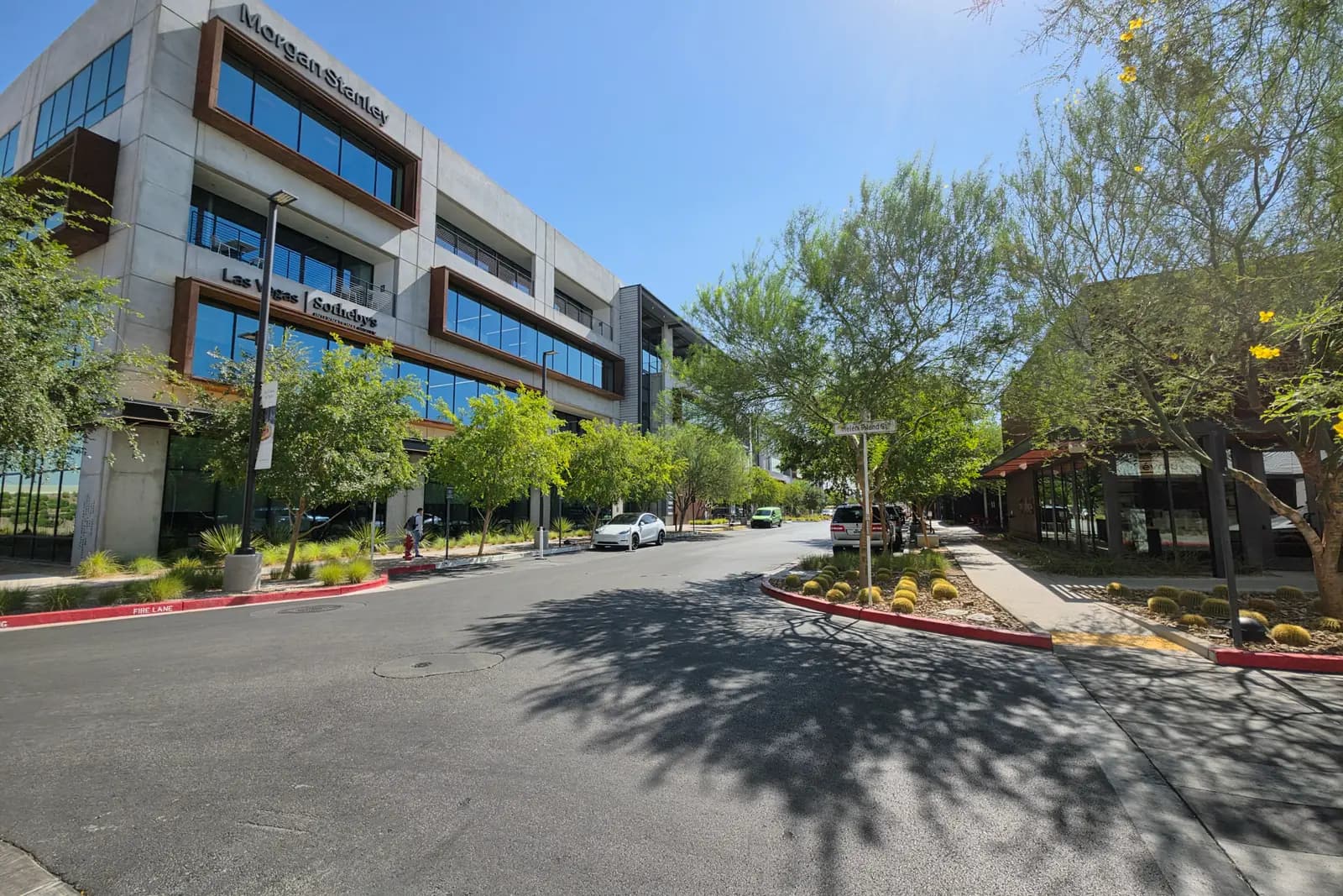
Here’s what you notice in the first hour, in roughly the order you notice it.
The neighborhoods change faster than you expect. A polished gated entrance, then an arterial, then a strip center, then a field. Then another gated entrance that looks nothing like the first one. Master-planned stretches read as coherent: matching walls, consistent landscaping, a plan you can feel. The non-master-planned stretches in between read as a series of independent decisions, because that’s exactly what they are.
Old and new sit right next to each other. A 1990s street with grown trees can be across the road from something finished last year with saplings staked against the wind. Housing age out here isn’t a gradient from the middle of town outward. It jumps around, and so does what your money buys.
The unfinished parcels are everywhere. Newer retail facing raw desert. A sidewalk that stops. A beautiful street that ends at a wall. None of that is decline. It’s an area mid-build, but if half-built horizons would wear on you, you should know that going in.
The apartments cluster, and the big lots hide. Multifamily concentrates along the arterials, especially around Durango and the beltway. Meanwhile, tucked off the main roads, there are pockets of genuinely large lots (some with room for a horse) that feel almost rural despite being ten minutes from a freeway. Both are normal here. Neither is what the drone footage shows you.
And you will drive. All of it. The street grid is wide and fast, the blocks are long, and the distance between a house and anything useful is measured in miles. That’s my read from driving it, not a statistic. I’m not going to quote you a walkability score I can’t stand behind. RTC buses do run the main corridors; the Rainbow and Durango routes exist and people use them. But the area was planned around driveways, and it shows. If you’re coming from somewhere you didn’t need a car, this will be the adjustment, and a bigger one than the heat.
The exception is the Durango corridor, where UnCommons and The Bend have built a couple of blocks you genuinely walk around once you’ve parked. It works. It’s also about the size of a couple of city blocks in an area of tens of square miles, and I’d be selling you something if I implied otherwise.
The southwest wasn’t designed to be walked. It was designed to be driven, quickly, and it’s honest enough not to pretend otherwise.
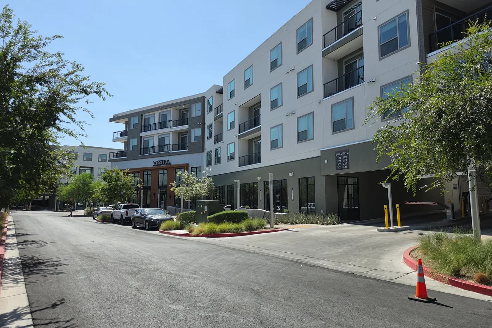
Communities and neighborhoods
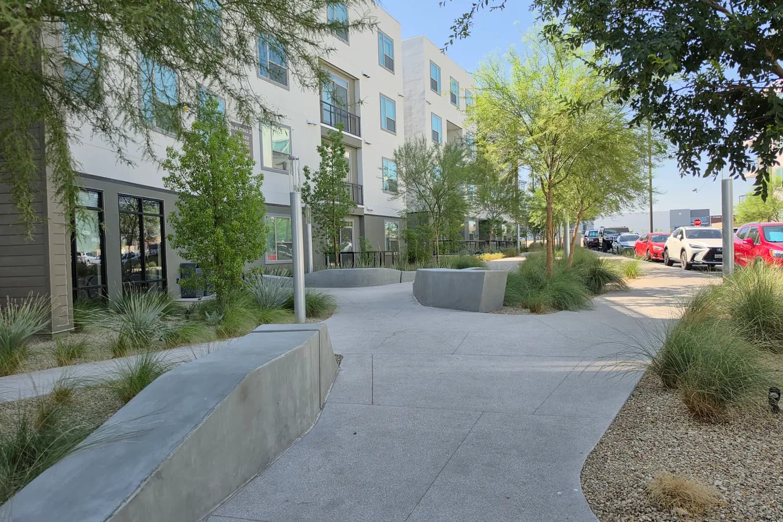
The names you’ll hear on repeat, and what actually separates them. This is not a complete list, because the Southwest is a patchwork of far more builder tracts than it has famous names, but if someone is describing where they live out here, it’s probably one of these.
Mountain's Edge
South of Blue Diamond Rd, west of Rainbow Blvd
The biggest single master plan out here, roughly 2,500 acres inside the town of Enterprise, running right up against the desert at the southwest corner of the valley.
- Housing
- Overwhelmingly 2000s-and-later single-family, in a long run of separate builder subdivisions. Some gated, most not.
- What makes it different
- Parks and trails are the reason people cite it. Clark County set aside around 700 acres across the plan for public facilities, and Exploration Peak and Mountains Edge Regional Park are genuinely big pieces of open space, not token greenbelt.
Worth a look if you want newer suburban housing with real parkland attached and you're relaxed about being at the far southwest edge, well away from Downtown Las Vegas.
Rhodes Ranch
Around Durango and Fort Apache, north of Warm Springs
A guard-gated master plan wrapped around a public golf course, assembled from the mid-1990s and largely built out well before the newer subdivisions around it.
- Housing
- One- and two-story single-family behind a staffed gate, plus condo and townhome pockets. Older stock than most of the Southwest, so mature landscaping.
- What makes it different
- The gate and the golf course. It reads as a self-contained place in a way most of the surrounding grid does not, and the trees have had time to grow.
Worth exploring if you want a guarded entrance and an established, finished feel, and you'd trade the newest possible construction to get it.
Nevada Trails
Between Rhodes Ranch and the Rainbow corridor
An early-2000s Pardee community sitting in the middle of everything, with the gated Estates at Nevada Trails inside it. Quieter and less talked-about than its neighbors.
- Housing
- Single-family from the early 2000s, a wide range of floor plans, with a gated section and non-gated streets in the same community.
- What makes it different
- It's the clearest example of how fast the Southwest changes street to street. It's ringed by Rhodes Ranch, Mountain's Edge and Southern Highlands, and doesn't feel like any of them.
Worth driving if you want something twenty-odd years old rather than five, central to the area's arterials, without paying for a master-plan name.
Southern Highlands
The southern edge, either side of I-15
A roughly 2,300-acre master plan in Enterprise built around a private golf club, at the very bottom of the valley. Whether it counts as Southwest is genuinely disputed.
- Housing
- The widest range in the area: production single-family through custom and guard-gated estate housing, plus townhomes and condos.
- What makes it different
- Its access is oriented to I-15 and St. Rose rather than the 215, which makes daily life here point south and east while the rest of the Southwest points north and west.
Worth exploring if I-15 is your commute, or if you want a wider spread of price points and lot sizes inside one master plan.
The Durango corridor
Durango Dr at the CC-215, around Sunset and Warm Springs
Not a residential community. It's a commercial spine. UnCommons, Durango Casino & Resort, IKEA and The Bend all sit within about a mile of each other here, with apartments filling in around them.
- Housing
- Apartments and mid-rise rentals rather than for-sale housing, with established single-family subdivisions immediately behind on the side streets.
- What makes it different
- It's the only part of the Southwest where you can park once and walk between things. That's new, it's deliberate, and it's about the size of a couple of city blocks.
Worth exploring if you want to rent first, or if you want to buy nearby and have somewhere to walk to on a Saturday without getting back in the car.
Enterprise
Most of the map, and then some
An unincorporated Clark County town of about 67 square miles, not a neighborhood. It swallows most of what people call Southwest, plus a good deal that nobody would.
- Housing
- Everything. Master plans, 1990s subdivisions, brand-new infill, larger-lot and semi-rural pockets, apartment corridors and horse property, all under one town name.
- What makes it different
- It's an administrative unit, not a place with a character. If someone tells you a home is 'in Enterprise' they've told you which town advisory board covers it and almost nothing else.
Useful to know because it's what your address, your permits and your county services actually attach to, but don't shop by it. Shop by the subdivision.
Each of these will get its own full guide over time. Until a guide’s actually written, the name stays plain text rather than a link. No dead ends.
Southwest Development Watch
Updated August 2026
The Southwest changes faster than any page can keep up with, and most of what you’ll find searching for it is two years stale. Here’s where things actually stand, split by what’s genuinely open, what’s genuinely being built, and what’s only been announced. Every status below is sourced, and if I couldn’t verify which of the three a project was in, it isn’t here.
Open now
Built, operating, and something you can go stand in today.
UnCommons
OpenDurango Dr, just south of the CC-215
A 40-acre mixed-use campus with four office buildings (all of them leased) plus restaurants, coffee, a coworking space, an event venue, a central plaza and the Vestra apartments. It's the most concentrated attempt anyone has made at building the Southwest a center.
The developer's own marketing quotes full build-out targets for office square footage and residential units. Those are targets, not what exists.
Status via Matter Real Estate Group / NVBEX, June 2026
The Bend
OpenSunset Rd between Durango Dr and Riley St, across from IKEA
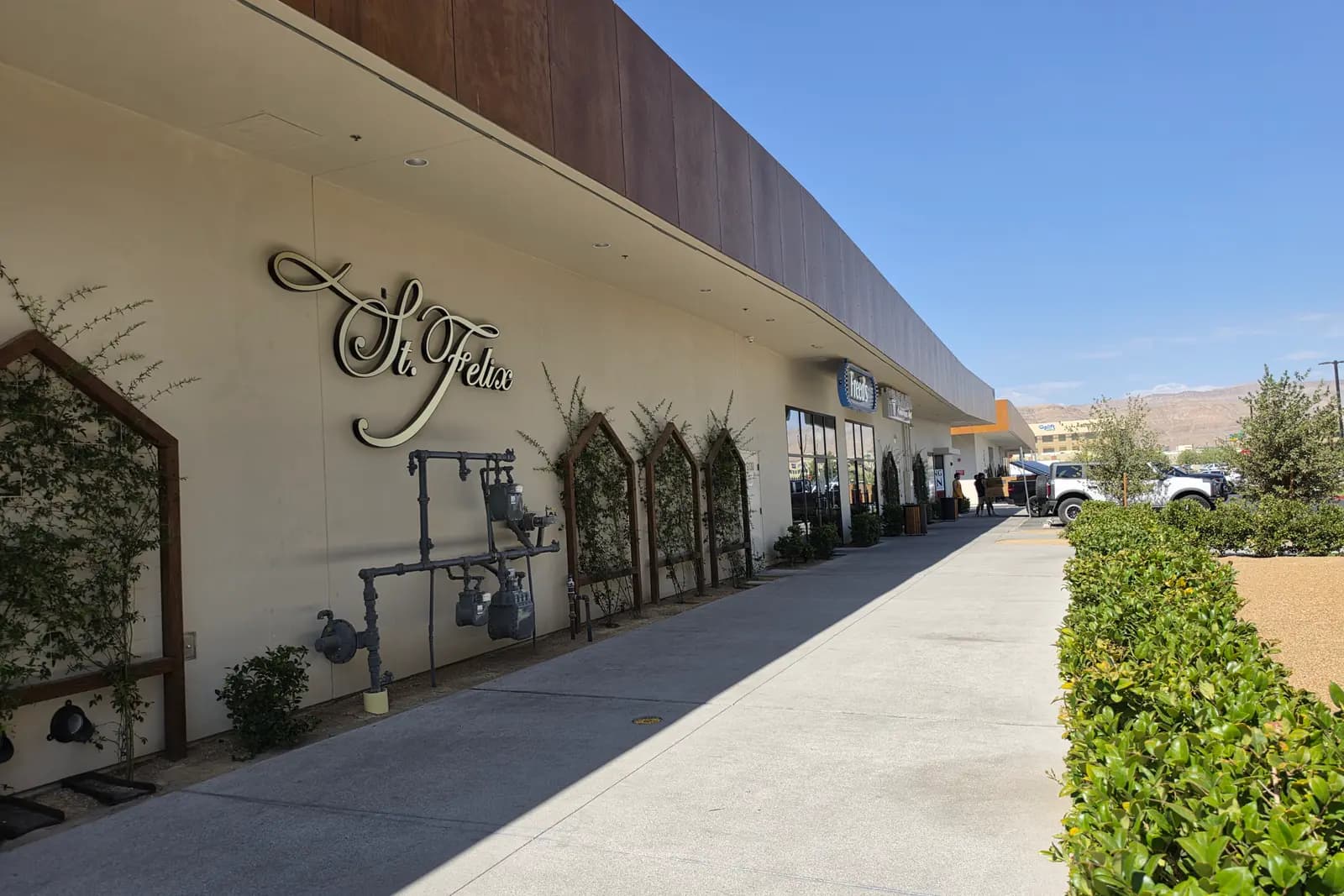
Dapper Companies' dining and retail development on roughly ten acres. Substantially open and busy, with Electric Pickle, Mothership Coffee, Marufuku Ramen, Aces & Ales, St. Felix, Freed's, Butcher & Thief, and further phases still to come.
Published square footages conflict between sources, so none is stated here.
Status via LVINIT site visit, July 2026 · tenants via Las Vegas Review-Journal
Rainbow & Blue Diamond industrial parks
OpenS Rainbow Blvd around Richmar Ave, south of Blue Diamond Rd
Two completed logistics developments: Panattoni's 422,000 sq ft Oasis Commerce Center and the four-building, roughly 256,000 sq ft Rainbow @ Blue Diamond park. Worth knowing about if you're looking at homes nearby: this corner of the Southwest is a working industrial corridor now, with the truck traffic that implies.
Oasis Commerce Center's completed status is per CBRE's leasing listing for the property, not the developer.
Status via EBS Realty Partners
Under construction
Ground has actually been broken. Dates still move.
Durango Casino & Resort: third expansion phase
Under constructionDurango Dr at the CC-215, on the north parking lot
Station Casinos began a $385 million, roughly 275,000 sq ft expansion in January 2026, adding a 36-lane bowling center, movie theaters, restaurants and food-hall outlets, more gaming and further entertainment space. The resort stays open throughout.
Reported as roughly an 18-month build. No firm opening date has been published, and no hotel tower is part of this phase.
Status via CDC Gaming, January 2026
Desert Flow at Southwest Ridge Bike Skills Park
Under constructionWarm Springs Rd at Fort Apache Rd
A 17-acre Clark County bike park with skills courses, a pump track, dirt trails, a 12-foot-wide paved main trail, an entry plaza, restrooms, shade and a 50-space lot. Ground was broken in late January 2026 and the county's page says construction is underway.
The county said it hoped to open the park by the end of 2026. That's a hope, not a published opening date.
Status via Clark County Parks & Recreation
Life Time
Under constructionDurango Dr at Sunset Rd, across from IKEA
A 128,000 sq ft athletic club going up on the Durango corridor, reported as scheduled to open in late 2026.
Status via Las Vegas Review-Journal, projects to watch in 2026
CC-215 on-ramps at Sunset and Durango
Under constructionCC-215 at Sunset Rd and Durango Dr
Clark County Public Works is rebuilding the ramps at the two busiest Southwest beltway interchanges, including widening the westbound CC-215 off-ramp at Durango to add a left-turn lane onto southbound Durango. Expect lane restrictions here for a while.
Status via Clark County Public Works
Sunset Road: Durango to Decatur, Phase 1
Under constructionSunset Rd, Durango Dr to Decatur Blvd
A county roadway project along the Sunset corridor, the main east-west connector across the north edge of the Southwest.
Status via Clark County Public Works: projects in construction
Rainbow Boulevard: Blue Diamond to the CC-215
Under constructionRainbow Blvd, Blue Diamond Rd to CC-215
County work along the Rainbow corridor through the middle of the Southwest, the stretch that carries traffic between Mountain's Edge, the industrial parks and the beltway.
Status via Clark County Public Works: projects in construction
Planned or proposed
Announced, approved, or designed, but not built. Treat renderings accordingly.
UnCommons fifth office building
PlannedWestern end of the UnCommons campus, Durango Dr
Matter Real Estate Group announced the campus's fifth and final office building in May 2026: three stories on a 1.4-acre parcel between the DraftKings building and a parking garage, about 39,000 sq ft of office over roughly 20,000 sq ft of ground-floor retail, targeted to be tenant-ready in the first quarter of 2028.
Announced, not started. No construction start date has been published, so treat renderings accordingly.
Status via NVBEX, June 2026
Domus at UnCommons
PlannedUnCommons campus, Durango Dr
A second residential phase of roughly 454 units, reported as still in design.
In design. Not approved for construction as far as we can verify.
Status via Las Vegas Review-Journal
Clark County has further roadwork in construction across this side of the valley, including the Warm Springs Road corridor, the CC-215 frontage road between Sunset and Decatur, and the South Beltway widening from Decatur to I-15. The county’s projects-in-construction list is the live version and is worth a look before you commit to a commute. Statuses here were checked on 20 August 2026 and will move. Check with the developer or the county before planning around any of them.
What the housing is actually like
The dominant product is a newer single-family home, often behind a gate, in a subdivision built by one builder over a short window. But the range around that is wider than the reputation suggests, and the differences are worth knowing before you start looking.
Master-planned versus not. Inside a master plan (Mountain’s Edge, Southern Highlands, Rhodes Ranch) you get consistency: coordinated landscaping, planned parks, a general design logic. Outside one, you get whatever each builder did on each parcel, which can mean more variety and sometimes more house for the money, with less of a plan around it.
Resale versus new build. Both are genuinely available here, which isn’t true everywhere in the valley. Resale in the Southwest often means an early-2000s home with a grown yard on a finished street. New build means the current spec, the current warranty, and living beside a construction site for a while. There’s no right answer, but they’re different purchases.
Gates, golf, and everything else. Guard-gated and self-gated communities are common, and two golf-centerd master plans (Rhodes Ranch with a public course, Southern Highlands with a private one) anchor their own housing markets. Townhomes and condos exist in meaningful numbers, mostly nearer the arterials. Apartments concentrate along Durango and the beltway. And in scattered pockets there are genuinely large lots, occasionally with horse privileges, that don’t look like anything else out here.
HOAs and housing age vary enormously. Check both, per address. There is no such thing as “the Southwest HOA situation.” Some communities have a master association plus a sub-association; some have essentially nothing. Housing age jumps from the mid-1990s to this year within a few blocks. Those two facts do more to determine what living somewhere out here is like than the area name does.
On prices, and why there isn’t a number here
I’m not going to publish an “average Southwest Las Vegas home price,” and I’d be careful with anyone who does. You’ve just read a thousand words explaining that this area has no agreed boundary, which means any median quoted for it depends entirely on where the person calculating it decided to draw the line. Include Southern Highlands and it moves. Include the Spring Valley overlap and it moves again. Nobody publishes a defensible Southwest submarket median, because there isn’t a defensible submarket.
What does exist is the valley-wide figure, and I keep that current in the monthly market read. For what a specific budget actually gets you, including a real Southwest home, the $500K walkthrough is more useful than any average would be. Real pricing here is a conversation against current listings, not a page like this.
Southwest vs Summerlin
This is the comparison most people are actually making, so let’s do it properly. No scores, because there isn’t honest data to score these on. Just which way each dimension leans and why.
- A more cohesive, master-planned environmentOne developer, one plan, decades of execution. The Southwest is many separate plans that happened to fill the same area.
- Leans towardSummerlin
- More variety in neighborhood types and housing stockGated master plans, 1990s subdivisions, brand-new infill, larger-lot pockets and apartment corridors, sometimes within a mile of each other.
- Leans towardSouthwest
- A closer connection to Red Rock and west-valley recreationIt sits directly against the conservation area.
- Leans towardSummerlin
- Strong 215 accessThe beltway serves both, and which one is quicker depends entirely on the specific address and the direction you're heading.
- Leans towardBoth
- More visible infill and undeveloped parcelsLarge sections are still being finished, so vacant land and active construction are a normal part of the view.
- Leans towardSouthwest
- An established, centralized commercial coreDowntown Summerlin is a genuine center. The Southwest's nearest equivalent, the Durango corridor, is newer and smaller.
- Leans towardSummerlin
The short version: Summerlin is one plan executed over decades and you can feel the plan. The Southwest is many separate developments that filled the same area over the same period, next to each other rather than with each other. You trade cohesion and a center for newer housing, more variety, and frequently more square footage. The Summerlin guide is the honest version of the other side.
Southwest vs Henderson
This one is less a comparison than a category error, and it’s worth naming. Henderson is an incorporated city. It has its own government, its own police, its own parks department and its own rules, and it contains an enormous range of very different places, from new master plans to a historic downtown to hillside estates to lake communities. Reducing it to one lifestyle is as wrong as reducing the Southwest to one.
The Southwest is an informal name for a stretch of unincorporated county. So the real difference isn’t vibe, it’s structure: in Henderson you’re a resident of a city that answers to you; in most of the Southwest you’re a resident of Clark County. If separate-municipality matters to you (and for some people it genuinely does) that’s a real distinction rather than a marketing one. Geographically they’re at opposite ends of the valley’s southern edge, so the practical question is usually just which side your work and your people are on.
The full Henderson guide breaks the city down community by community, which is the only useful way to think about it, and the full Henderson vs. Southwest Las Vegas comparison goes through this pairing properly.
Not sure which side of the valley fits you?
Summerlin, Henderson and Southwest can all work for someone moving to Las Vegas, but for very different reasons. This comparison breaks down how the three areas actually differ once you get beyond the house itself.
Filming now. The video lands on this page when it publishes.
Southwest Las Vegas, answered
The questions people actually type in, answered as precisely as the facts allow, which sometimes means answering “it depends,” and saying why.
What is considered Southwest Las Vegas?
- Loosely, the part of the valley south of Tropicana and west of I-15, centerd on the Durango, Fort Apache and Rainbow corridors and the stretch of the 215 Beltway that curves through them. Most people mean roughly Russell Road down past Blue Diamond, and Hualapai across to about Decatur. There is no official version of that line, so two locals can use the term and mean noticeably different areas.
Is Southwest Las Vegas a city?
- No. It isn’t a city, a town, or a census place. It’s a colloquial name. Most of it isn’t even inside the City of Las Vegas: it’s unincorporated Clark County, so your mailing address says Las Vegas while your permits, code questions and local services go through the county.
Is Enterprise the same as Southwest Las Vegas?
- They overlap heavily but they aren’t the same thing. Enterprise is a real administrative unit, an unincorporated town of about 67 square miles that Clark County administers. It covers most of what people call Southwest, and also plenty that nobody would. Southwest is a name people use; Enterprise is a line on a county map.
Is Southwest Las Vegas inside the City of Las Vegas?
- Mostly no. The bulk of it sits in unincorporated Clark County, across the towns of Enterprise and Spring Valley. That matters less than people expect day to day, but it decides who you call about a permit, a pothole or a code question.
Is Mountain's Edge in Southwest Las Vegas?
- Yes. It’s one of the areas people most reliably mean. Clark County describes it as a master-planned community of about 2,500 acres inside the town of Enterprise, generally south of Blue Diamond Road and west of Rainbow Boulevard.
Is Rhodes Ranch in Southwest Las Vegas?
- Yes. It sits in the middle of the area around Durango and Fort Apache, and it’s one of the older communities out here: guard-gated, wrapped around a golf course, and built out largely before the subdivisions around it.
Is Southern Highlands considered Southwest Las Vegas?
- Sometimes. It’s in the same county town, Enterprise, but it sits at the very bottom of the valley against I-15, and its access points south and east rather than to the 215. Plenty of locals treat it as its own thing. That disagreement is exactly why this page draws two outlines on the map instead of one.
How far is Southwest Las Vegas from the Strip?
- Close enough that it’s not a problem, and too variable to put a number on. The area is big. A home off Blue Diamond and a home at Durango and the 215 aren’t the same trip, and the answer swings with the hour. Getting to the south Strip and Harry Reid International is the easy direction from most of the Southwest; crossing the valley northeast at rush hour is the hard one. Drive it yourself at the time you’d really be driving it.
Is Southwest Las Vegas the same as Summerlin?
- No, and they’re close to opposites in how they were made. Summerlin is one master plan built out over decades, with a real center in Downtown Summerlin. The Southwest is dozens of separate developments that filled the same area over the same period. You can read the full Summerlin guide for the other side of that trade.
What neighborhoods are in Southwest Las Vegas?
- The names you’ll hear most are Mountain’s Edge, Rhodes Ranch, Nevada Trails, Southern Highlands and the newer development along the Durango corridor, all inside the county towns of Enterprise and, at the north end, Spring Valley. There are many more subdivisions than that; the area is a patchwork of separate builder tracts rather than a small set of named neighborhoods.
So should you look here?
Look here if a newer home matters to you, if the beltway solves your commute, if you’re relaxed about driving, and if you’d rather have more house than more character. That’s a completely reasonable set of priorities, and the Southwest serves it better than almost anywhere else in the valley right now.
Look elsewhere if you want to walk places, if you want a neighborhood with a history and a center, or if construction noise and half-built horizons would grind on you. The Arts District is the opposite instinct entirely, and Summerlin is the polished version of the same suburban idea.
My actual advice, and it costs nothing: pick a Tuesday, drive Durango from Blue Diamond up to the 215, then cut across Warm Springs, and do it at the hour you’d really be commuting. You’ll know within twenty minutes whether this is your side of town. It’s a place that reveals itself from the driver’s seat, which is fitting, because that’s where you’d be living.
Photographed in southwest Las Vegas on 16 July 2026. Development status (what’s open, under construction, or only announced) was checked on 20 August 2026 and will change; check with the developers or Clark County before planning around it.
Sources & updates · Checked 20 August 2026
- Clark County Comprehensive Planning: EnterpriseEnterprise as an unincorporated town administered by Clark County; 42,950 acres / about 67 square miles.
- Clark County Comprehensive Planning: Mountain's EdgeMountain's Edge acreage, location, land-use split and the roughly 700 acres of public facilities.
- Clark County Public Works: projects in constructionWhich Southwest road projects are actually in construction rather than in design.
- Clark County Parks & Recreation: Desert Flow Bike ParkDesert Flow's size, location and under-construction status.
- Las Vegas Review-Journal: southwest valley growthEnterprise growth of almost 60% from 2010 to 2023 against about 20% valley-wide, and 245,243 residents at the end of 2023. The underlying figures are Esri's, not the county's.
- NVBEX: UnCommons fifth office buildingThe fifth office building's size, parcel, Q1 2028 target and announced-not-started status.
- CDC Gaming: Durango Casino expansionThe $385 million third-phase expansion, its January 2026 start and what it adds.
- Las Vegas Review-Journal: projects to watch in 2026Life Time at Durango and Sunset: 128,000 sq ft, scheduled to open late 2026.
- CBRE: Oasis Commerce CenterThe Panattoni industrial development at Rainbow and Richmar being complete, at 422,000 sq ft.